Reliable & Sustainable Water Engineering Solutions
Advanced Hydrologic, Hydraulic, Hydrographic & Morphological Engineering Services — delivering precision solutions for Bangladesh's water future.
Pioneering Water Intelligence Since 2010
AHYDTECH combines innovation, precision, and efficiency to solve complex water resource challenges — helping build a sustainable future for Bangladesh and beyond.
We believe in excellence and innovative thinking. Our goal is to use global experience to manage Bangladesh's water resources effectively, protecting the environment and building reliable infrastructure for everyone.
Established in 2010 by Dr. Bahar SM, AHYDTECH Geomorphic Ltd. emerged as a leading consultancy in Water Resources Engineering, Environmental Science, and Fluvial Geomorphology. With Dr. Bahar's extensive 28-year tenure, the company has executed over 70 coastal engineering projects primarily along the Great Lakes of Ontario.
Our portfolio boasts collaborations with prominent conservation authorities and municipalities. Bangladesh operations have since grown to deliver transformative projects across rivers, coasts, wetlands, and hydraulic infrastructure.
Dr. Bahar SM
Founder & Managing Director
28+ years in Water Resources Engineering · PhD · International Expert
Our Journey
AHYDTECH Geomorphic Ltd. established in Canada by Dr. Bahar SM
AHYDTECH Water Resources BD Ltd. launched Bangladesh operations
Expanded to 30+ senior engineering professionals
Advanced drone & LiDAR survey fleet acquired
Vision & Mission
Precision Engineering
State-of-the-art tools combined with 28+ years of expertise for high-accuracy deliverables.
Innovation & Technology
Integrating cutting-edge hydrodynamic models and digital survey technologies.
Global Standards
International-standard methodologies and rigorous quality control processes.
Sustainable Impact
Engineering resilient water infrastructure that harmonizes development with nature.
Specialized Engineering Capabilities
Comprehensive water resources solutions from hydrodynamic modeling to precision field surveys — all under one roof.
Hydrologic & Hydrodynamic Modeling
River, Canal, Wetland & Coastal Waterbodies
Advanced 1D/2D hydrodynamic modeling to simulate flood dynamics, water levels, velocity fields, and bed shear stress for risk assessment and infrastructure design.
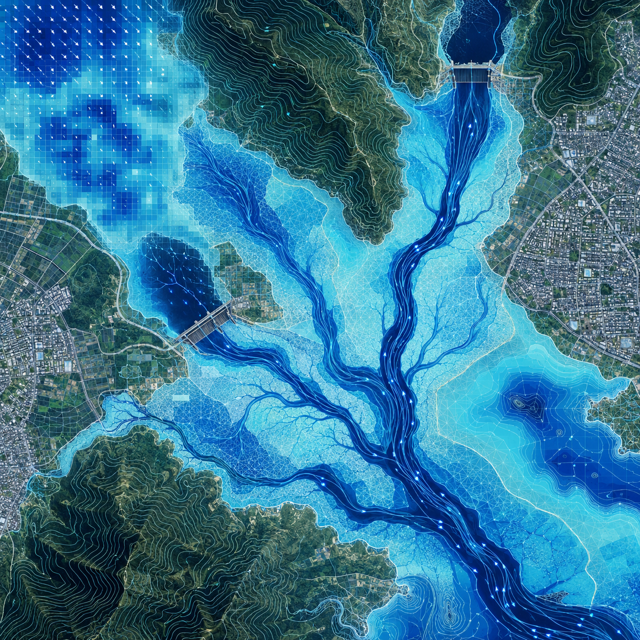
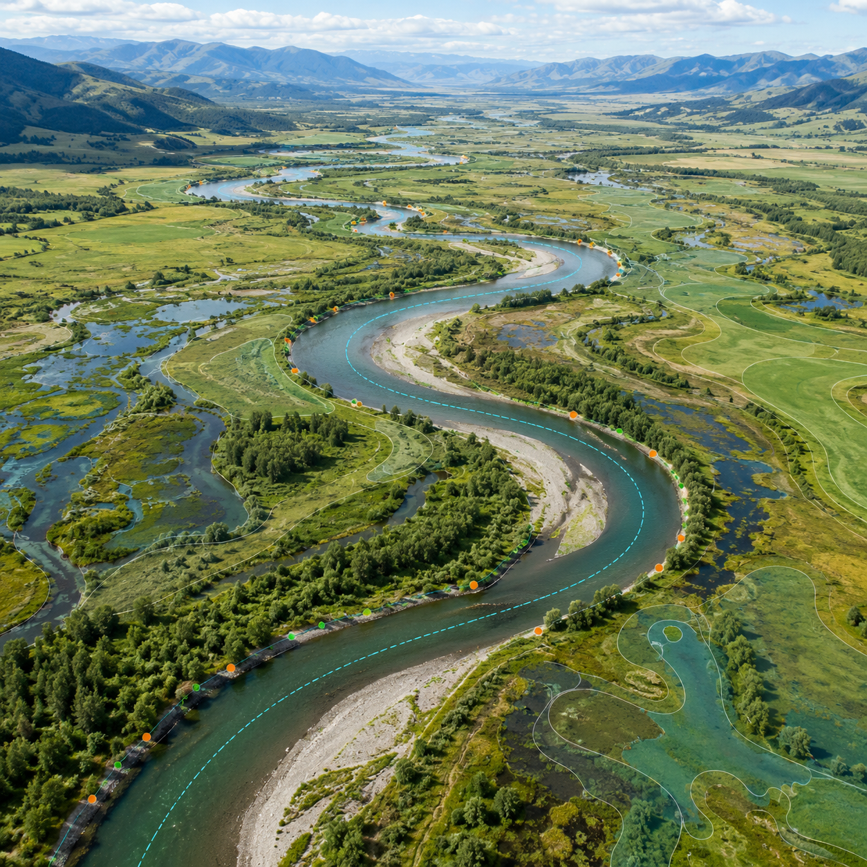
Sediment Transport & Morphological Analysis
River Migration, Bank Erosion & Channel Stability
Comprehensive assessment of riverbed dynamics, sediment load, channel migration patterns, and morphological stability for navigation and infrastructure protection.
Hydro-Morphological Study
Bridges, Culverts, RTWs & Water Crossing Structures
Site-specific hydraulic and morphological studies for bridges, road culverts, and river training works — delivering design parameters and scour depth analysis.
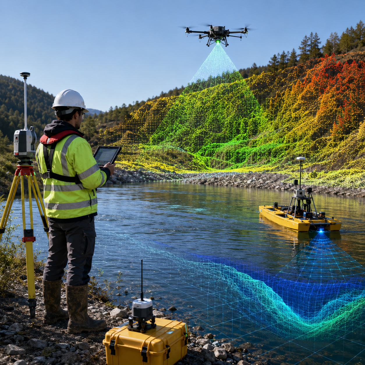
Topographic, Drone, LiDAR & Hydrographic Survey
RTK GNSS, Multi-beam Sonar & Aerial Photogrammetry
End-to-end precision survey services combining drone-based LiDAR, multi-beam sonar bathymetry, ADCP discharge measurement, and RTK ground control.
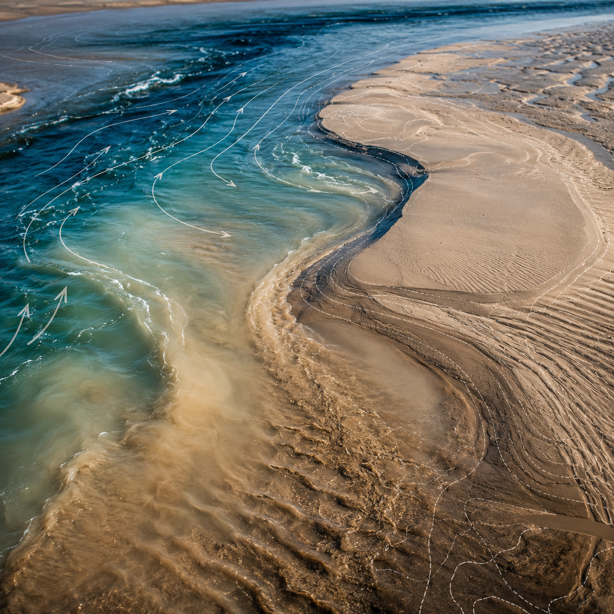
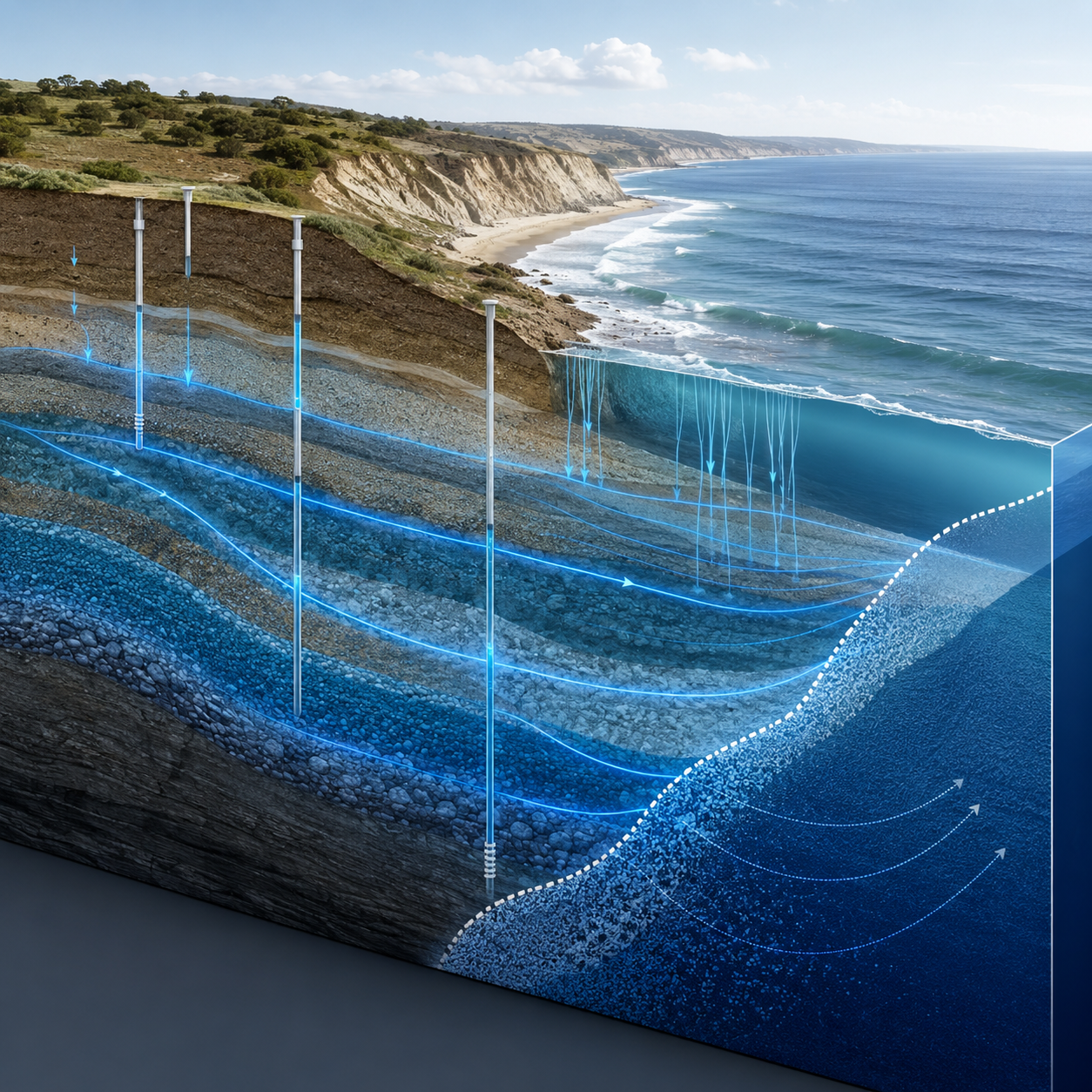
Coastal & Groundwater Modeling
Coastal Hydrodynamics, Storm Surge & Aquifer Analysis
Specialized modeling of coastal wave dynamics, storm surge propagation, tidal interaction, and groundwater flow systems for coastal protection and resource management.
Our Instrument Fleet
16 industry-leading survey instruments — RTK GNSS, multi-beam sonar, LiDAR drones, ADCP, and underwater cameras.
Software Arsenal
25+ industry-leading simulation tools for hydrodynamic, hydrologic, morphological, and coastal modeling.
Hydrodynamic & Sediment
River, Canal & Coastal Waterbodies
Hydraulic Modeling
1D/2D River & Floodplain Analysis
Hydrologic Modeling
Rainfall-Runoff & Basin Hydrology
Groundwater Modeling
Aquifer Analysis & Groundwater Flow
Coastal Modeling
Storm Surge, Wave & Tidal Dynamics
GIS & Remote Sensing
Spatial Analysis & Mapping
Featured Projects
A portfolio of transformative water engineering, survey, and research projects delivered across Bangladesh.
Our Valued Clients
Trusted by government agencies, development banks, and international organizations across Bangladesh.


Why Choose Us
Eight compelling reasons why Bangladesh's leading agencies and international organizations trust AHYDTECH.
Expert Team
30+ senior professionals and 15+ junior/mid-level engineers specializing in water resources disciplines.
Full Spectrum
Full-spectrum from hydrodynamic modeling to construction supervision — all under one firm.
Software Arsenal
25+ industry-leading simulation tools: HEC-HMS, TUFLOW, MIKE 21, ADCIRC, MODFLOW, and more.
Survey Fleet
RTK GNSS, multi-beam sonar, LiDAR drones, and ADCP — latest generation survey technology.
Proven Track
Over 100 successfully completed projects since 2017 across rivers, coasts, and wetlands of Bangladesh.
Innovation
Continuously adopting next-generation methodologies and digital engineering workflows.
Client Focused
Transparent communication, regular reporting, and collaborative project management approach.
QA/QC
International-standard QA/QC processes ensuring accuracy and reliability at every deliverable.
Career Opportunities
Join Bangladesh's leading water resources consultancy. Work on impactful projects alongside experienced professionals.
Senior Hydraulic Engineer
Lead hydrodynamic modeling projects and mentor junior engineers on advanced flood simulation workflows.
Hydrographic Survey Specialist
Plan and execute bathymetric surveys using multi-beam sonar and ADCP across Bangladesh's major rivers.
Drone / LiDAR Survey Operator
Operate drone-based LiDAR and photogrammetry missions for topographic mapping and DEM generation.
GIS & Remote Sensing Analyst
Develop spatial analysis workflows, flood hazard maps, and geodatabase management for engineering projects.
Don't see a matching role?
We're always looking for talented water engineers, surveyors, and GIS specialists. Send us your CV and we'll get in touch when the right opportunity opens up.
Let's Work Together
Ready to start your water engineering project? Reach out to discuss your requirements with our team of experts.
Office Address
2nd Floor, House # 487, Road # 32,
New Mohakhali DOHS,
Dhaka-1205, Bangladesh